As ubiquitous as the Global Position System (GPS) is today for everything from navigating through shopping malls to tracking pizza deliveries, it’s difficult to imagine just how revolutionary it was for the aviation industry less than three decades ago.
When you think about it, 30 years hasn’t been an especially long time, but it’s been long enough for the accuracy of satellite navigation to relegate virtually every other form of aviation navigation to the point of back-up status.
It’s no great surprise that aviation has embraced GPS so strongly, though. Radio frequency navigation systems like VOR, ADF, and even Australia’s own DME, assuming coverage was even available, have always been prone to the kinds of natural and manmade influences that could interfere with terrestrial, non-directional beacon (NDB) signals.
GPS, on the other hand, leaves no questions about coverage or accuracy. It’s precise and it’s available almost everywhere around the globe at all times. And given the scope and affordability of today’s modern GPS equipment, it’s a system that’s simply too valuable even for any pilot not to choose it as their primary navigational aid.
Simplified navigation
Aerial navigation is dominated by two essential, real-time points: where an aircraft is relative to the earth in 3D, and where it’s going. From simple dead reckoning to the use of ground-based direction finders, there’s no shortage of navigation methods that pilots have at their disposal.
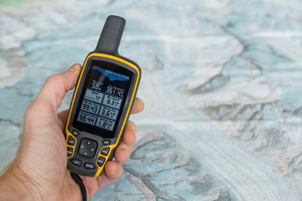
But among private pilots, reliable Garmin handheld GPS systems are regarded as the most trusted navigation aids available. Starting in 1990 with their first GPS unit, the Pronav 100, the Garmin brand is now synonymous with GPS expertise. From rugged wearable sport and recreational gear, to the some of the most advanced avionics in the world, Garmin has remained at the forefront of innovative GPS technology for 30 over years.
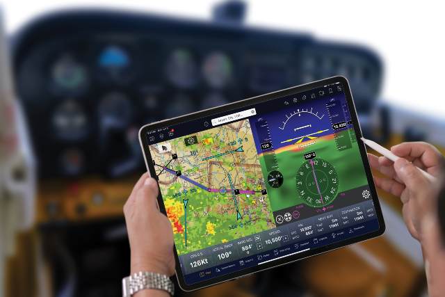
Their specialty though has always been aviation navigation and the Garmin Aera 660 arguably represents their finest, purpose-built unit yet when it comes to portable avionics. The Aera 660 is no less capable as it is compact, tipping the scale at only 1.5kg with a 5” capacitive touch screen display. Its equally advanced capabilities package however, includes:
· Built in network acquisition from both GPS and GLONASS satellite constellations;
· Simplified operation menu layouts that are sunlight readable;
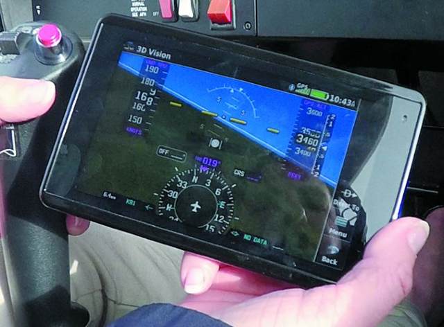
· 360° 3D Vision enhancement features with integrated terrain avoidance;
· Bluetooth cockpit connectivity with compatible weather, air traffic, and Automatic Dependent Surveillance – Broadcast (ADS-B) devices and other Garmin aviation products; and,
· Data connectivity with compatible flight plan navigators and radios.
In short, the Garmin 660 packs all the attributes of a pure, rack-mounted navigation unit into one that’s portable enough to fit into a pocket or flight bag, and is ready to fly within minutes after powering up. It’s the kind of simplified navigation that every pilot wants.
Situational Awareness
More than anything, Garmin avionics are known for maps and overlays that provide impeccable situational awareness. The Aera 660 is no exception and it features the complete range of aviation, geographic, and topographic data and landmarks that pilots expect, including:
· Airports, airways, VORs, and airspaces;
· Cities, highways, and railroads; and,
· Lakes, rivers, and other navigational aids.
The Aero 660 also displays this data in three different aircraft icon orientations:
· North Up. This aligns the top of the map to always orient toward north.
· Track Up. This aligns the top of the map to orient toward the direction the aircraft is traveling.
· Desired Track Up. This aligns the top of the map to orient toward the direction of the destination.
Its 3D navigation maps, however, depict the full spectrum of terrain, as well as any obstacles over 200’ above ground level (AGL) that might present a potential flight path hazard. These maps also have tapes and gauges for illustrating:
· Altitude;
· Ground speed;
· Vertical speed;
· Lateral and vertical deviation; and,
· Horizontal Situation Indication (HSI).
Suffice it to say, with such a broad array of situational tools at a pilot’s fingertips, Garmin aircraft avionics are designed to ensure maximum situational awareness is never more than an arm’s length away.
EFB ready
With its latest range of Australian charting and flight planning options, the Aera 660 also warrants merit for fulfilling the requirements to operate as either a Class I or Class II electronic flight bag (EFB). It’s a comprehensive suite of features that now allows these handy Garmin portable GPS devices to assume the role of critical, panel-mounted flight planning utilizing Civil Aviation Safety Authority (CASA) approved data for:
· Geo-referenced IFR en-route charts;
· VFR sectional charts; and,
· Airport runway, taxiway and holding charts.
The Garmin Aera can now step up as a device that can create, store, activate and modify up to 50 flight plans with up to 300 waypoints, and all but eliminate the need for paper in Australian cockpits. It’s the advantage of EFB that every pilot can appreciate.
The final word
With its quality, performance, and compact size, the Aera 660 immediately answers the question about whether, with so many other GPS-enabled devices out there, there’s a need for one that’s dedicated strictly to aviation.
Yes, there is, because the risks from depending on a lesser, multifunctional device are too great to ignore. That’s why when it comes to having the most advanced features and latest chart databases in a purpose-built package, there’s simply no substitute for what a Garmin handheld GPS has to offer.